Showing posts with label atlantis. Show all posts

Monday, May 7, 2007

Trail Riding at Riverside State Park

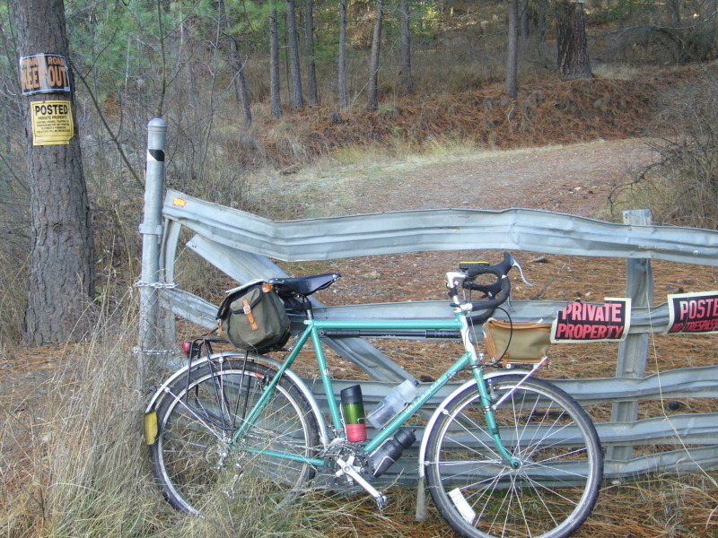
Well. There they are. Joe's super fancy nice Karate Monkey and my mountain-afied Rivendell Atlantis. We met up this morning and rode out to Riverside State Park to do the initial shakedown ride on our newly built-up bikes. A few thoughts on some of the stuff that plodded its way through my brain on the ride:
  • RSP is a wonderful place. We met downtown at 6AM and were on the trails by 6:40 or so-- we would've been earlier if we didn't noodle around on some trails around People's Park. The point: we're lucky to have such an amazing network of trials so close to town.
  • Riding rocky single track is a whole different ballgame with 2.1" knobbies when compared to 35mm semi-slicks. It's just more fun.
  • Riding 2.1" knobbies on smooth fire trail and pavement (the combination of both likely made up about 85% of our mileage this morning) is tiring and hard to get used to. Now I understand why so many folks drive their bikes to the trials. It's still cheesy. But I understand the temptation now.
  • A quick ride on the Karate Monkey confirmed something that I wasn't ready to concede: 29ers do appear to roll better for these conditions. In general Joe's bike is just bigger and feels right for the kind of riding we were doing. I'll need to spend more time on the KM before I am completely sold on the 29er idea. There are many differences between the bikes we rode this morning to attribute just to tire size. Plus, I know it's silly on the face of it, but really, 650b (584mm) does make a bunch of sense to me as a good mountain bike size. The Rivendell folks are building a 650b mountain bike. And Pancenti was showing a 650b mountain bike at NAHBS.
  • Mountain/Trail riding is all about the bursts of energy. I forgot about how in tune you need to be around shifting. You really need to anticipate your shifting if you want to stay on the bike over a series of steep descents and climbs. Aerobically, I was quickly peaking, then resting, then pushing. It will be fun to figure out the aerobic plan around trail riding.
  • Trail 25 at RSP is a great route. It's a giant circle that feeds a bunch of smaller trails. There is a newbie section there that Joe and I found. If you've gone to RSP and have ridden 25 all the way and without a person in the know, then you know what I'm talking about. A bit of sand. We'll leave it at that for the next set of rookies.
  • A guy could spend many many hours learning the trail system at RSP. This is an exciting prospect for me as I have tired of many of the local road routes I do.
  • Trail 204 -- going downhill is about the most fun I've had in a long while. Just a long straight descent with no obstacles.

If you are interested in joining us, Joe and I will be meeting Monday mornings throughout the summer to explore RSP. We'll meet at 5:30 AM on Monday mornings -- at Rocket Market in Carnegie Square. The idea will be to be back down town by 8:30.

Saturday, November 18, 2006

Private Property

I took a ride out to Liberty Lake yesterday to check out some of the small gray lines that are shown on my Spokane County map. I search out the small gray lines, which are dirt roads. And even better: small gray dotted lines, which are trails or just super-old roads. I enjoy doing long rides that include paved back roads, dirt roads, and if possible, some trail riding.
So, according to my map, there is a single gray small line that feeds into the Liberty Lake Regional Park at the northwest corner of the park. The gray lines work through the park and pop you out near Mica peak. Sounds like a perfect ride to me. I know you can access the LLRP by riding around the east side of Liberty Lake and going into the proper entrance to the park. But, I've already ridden about 20 miles by the time I get to Liberty Lake, and the map tells me there is a way around the west side. So, if it's there, then I want to find it.

As I had suspected, Liberty Lake has grown quite a bit since my grandmother rented a place on the lake out there about 20 years ago. Anything small and quaint appears to have been replaced by big and blingly. So, as I travel further southward, on the west end of the lake, I am increasingly wary of what I might find at the small gray lines that supposedly lie ahead.

Sure enough, the closer I get to the LLRP, the more "Private Property" and "No Trespassing" signs I see. The road ends at someone's "ranch". Errg. Of course I have no way of knowing if a public easement runs through the ranch's property to the road on the other side. And there is no way I'm going to ride through the "ranch's" property to find out.

My sense is that the owners of the "ranch" just put a "No Trespassing" sign up and were never questioned about it, thereby shutting off the only western road access to LLRP. I could be wrong. Maybe the right of way was never public. Maybe they tried to let folks respectfully cross their land to reach LLRP and they were burned by jerks tearing things up and leaving trash. I don't know.

I've made this mental note before; once again: I want to find an authority in Spokane County that I can get quick answers from. How can I find out if there is a right-of-way here?

I see this kind of stuff all the time as I search out my small gray lines. I've learned that "Roads" are always public, and "Lanes" are always private. So, "No Trespassing" signs posted on a "Road" can be ignored. I know that landowners routinely put up fences and signs on adjacent property or public right-of-ways when they want keep people out. Seeing some of the dumping and trash in the "gray line" areas: who can blame the landowners for taking matters into their own hands?

Sometimes I trespass, but I don't today. There are three opportunities that look really tempting. The most tempting is the one I take a picture of, above. Another one is right by the "ranch:" a single track trail meandering up the side of the mountain. Instead, I go down to the marsh and attempt to find a way into the park at the elevation of the lake. I end up on a beaver trail. Further along I am blocked at the pond Mr Beaver had built. It's too cold to go tromping around in the muck. In addition, the only viable trail out of the muck has multiple trees laying across it. The beaver has been busy.

I backtrack a few miles out of the south-west corner of the lake. I take a beautiful ride up Molter Road and have lunch looking over the Saltese Lake valley. From there I find Linke, a nice back road that is paved for a few miles then turns to dirt and warms me up with a gentle climb. Linke pops me out in Mica. From there, it's about 15 miles home -- a few muddy miles of which, I spend on "Summer Roads," which are like adding the perfect cup of coffee to a perfect chocolate dessert. A ride can be great without Summer Roads, but a great ride with Summer Roads is unforgettable. More on that later.